SEDA-COG Zoning Map Viewer
& Local Ordinance Catalog
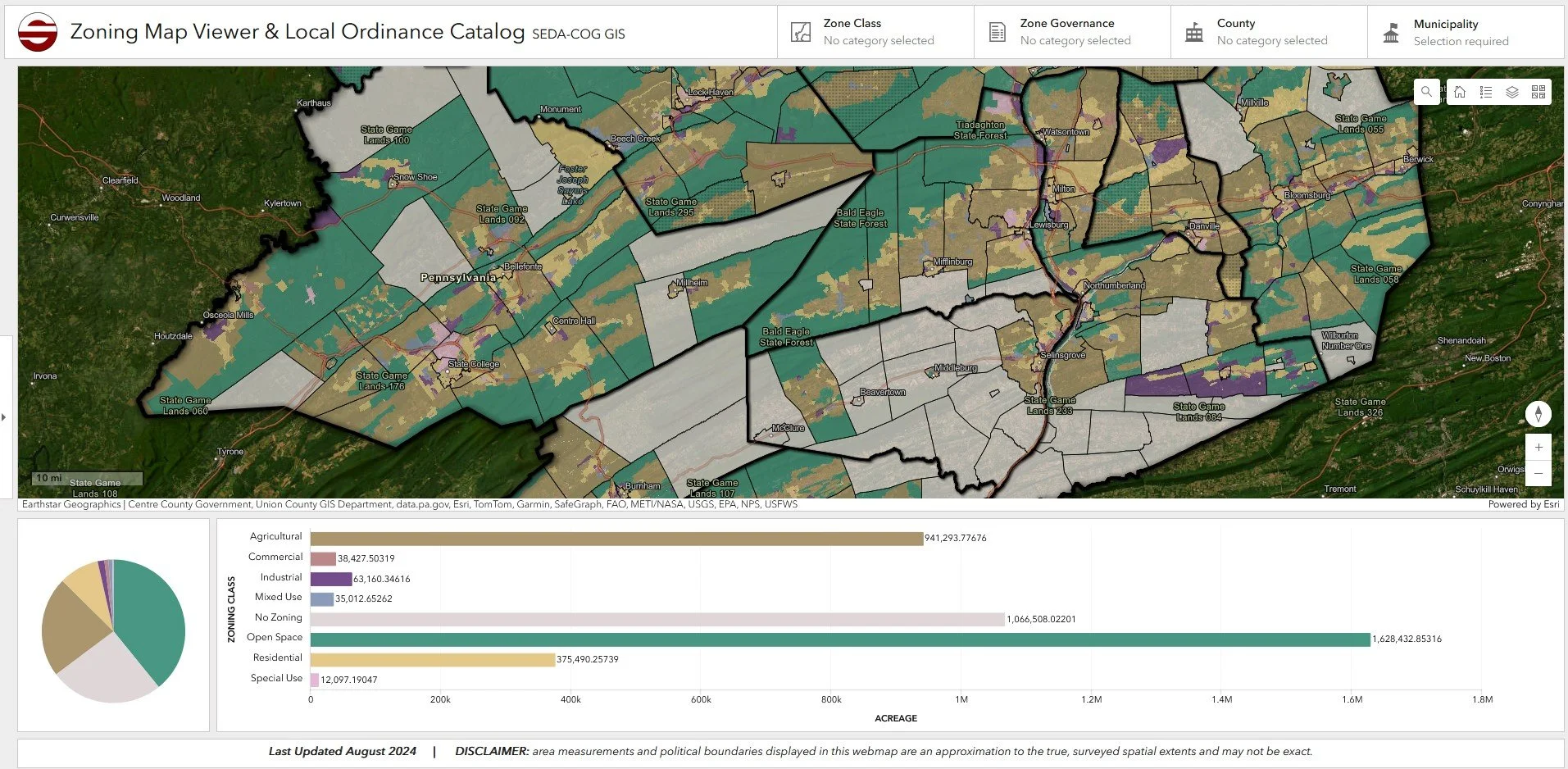
When I started my position at SEDA-COG, it quickly became evident that multiple departments often used zoning maps, whether it be for grant applications, land use planning, etc. I was frequently asked to make zoning reference maps for these projects, which started to take up a large portion of my work time. To streamline this process, I decided to create this ArcGIS Dashboard where my colleagues could access zoning information for the whole region with ease.
I created this dashboard by compiling (1) pre-made zoning layers provided by SEDA-COG member county GIS offices. If those were not available, I georeferenced official zoning maps in ArcGIS Pro to create the data myself. Zones were clipped to PennDOT political boundaries for conformity. Moreover, as zoning varies by its governing body, I organized zones into eight distinct zoning classes (i.e., Open Space, Residential). This allowed for the zones to be easily symbolized and compared to one another in the map.
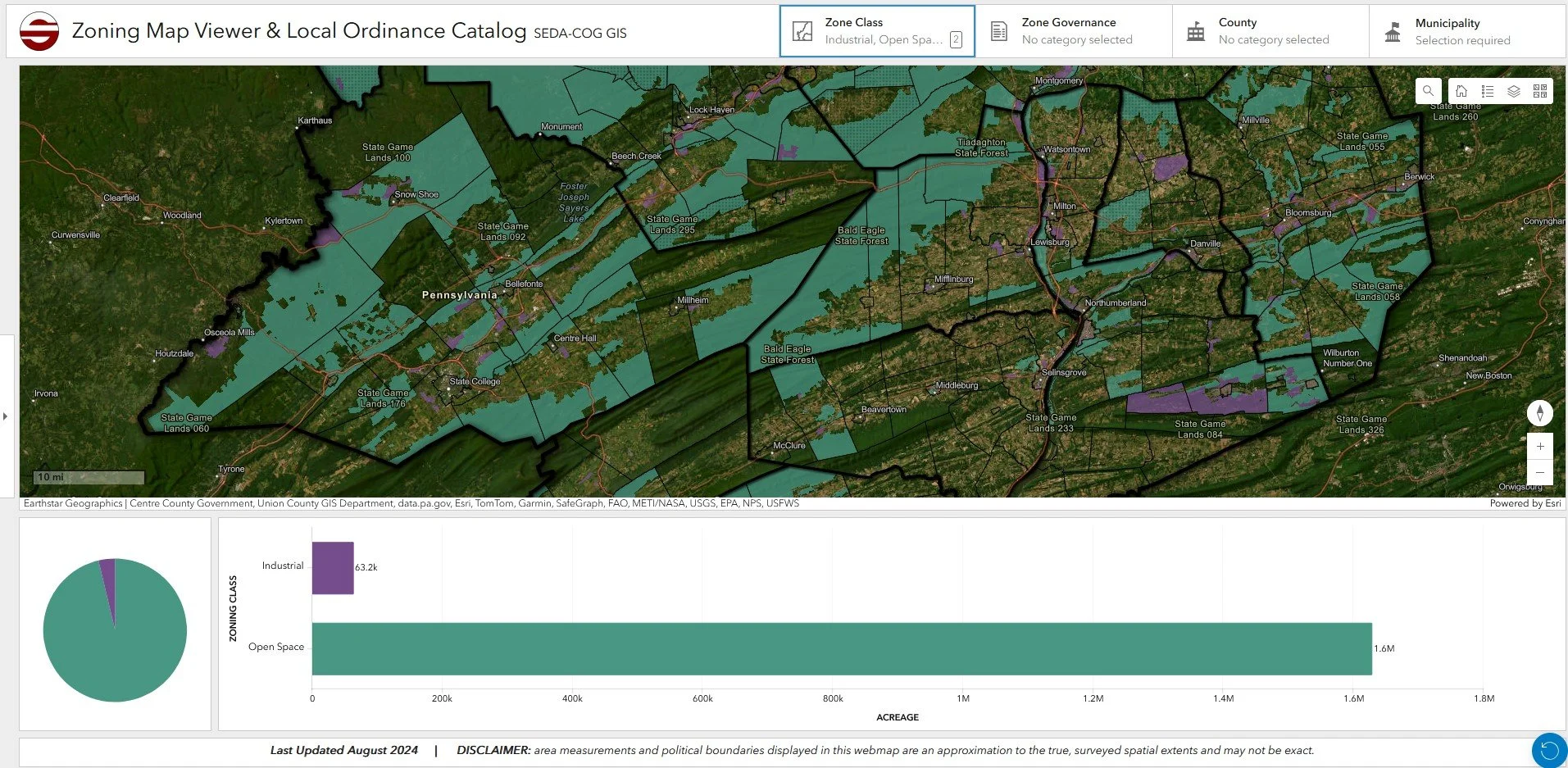
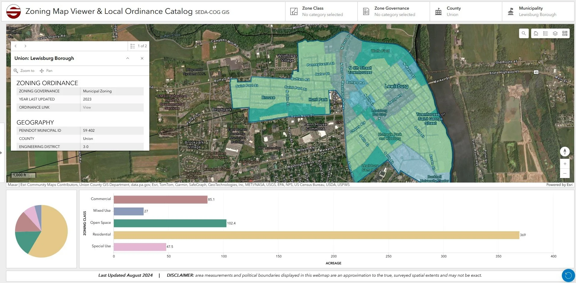
Within the dashboard, one can click on a municipality to access the online version of its zoning ordinance. Additionally, one can filter zones by class and governance by using the selectors at the top of the website. The goal for this dashboard is to be updated biannually to have the most up-to-date zoning data available to the office and SEDA-COG member counties as a reference tool.